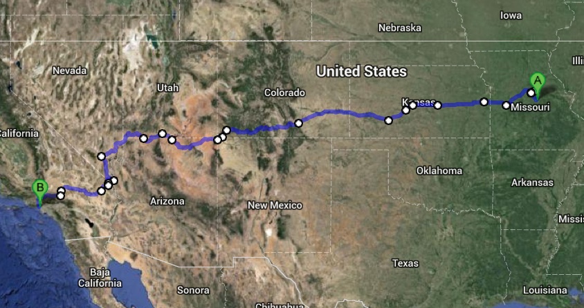
Here it is, the second half.. or more like 2/3rds of my route. It took a lot of work to find a route that keeps towns close enough together that I can carry enough water especially when it is illegal to walk on limited access highway, for good reason, and there is almost nothing else between Las Vegas and L.A. Thankfully there is a remnant of Route 66 to carry me to Victorville, CA and then I’m just a stone’s throw from the finish.
View Larger Map
That last leg will be the toughest, but once its done its smooth sailing. I’ll probably have to sleep during the day and walk at night … it will be interesting.
Give your tips in the comments!
Follow the Roam through email subscription or like the Roam on facebook!


2 Comments
I see that you decided to swing up to Columbia, MO and take the Katy Trail west a ways. I’m sure that you will have supporters in Columbia that are eager to see you and feed you too!
The part where you cut through “valley of fire” state park is a bit disconcerting. Any particular reason you’re coming into LA from the north by Santa Clarita rather than over by Victorville? As I recall, there’s less mountainous terrain over by Victorville.